 van wyk journeys
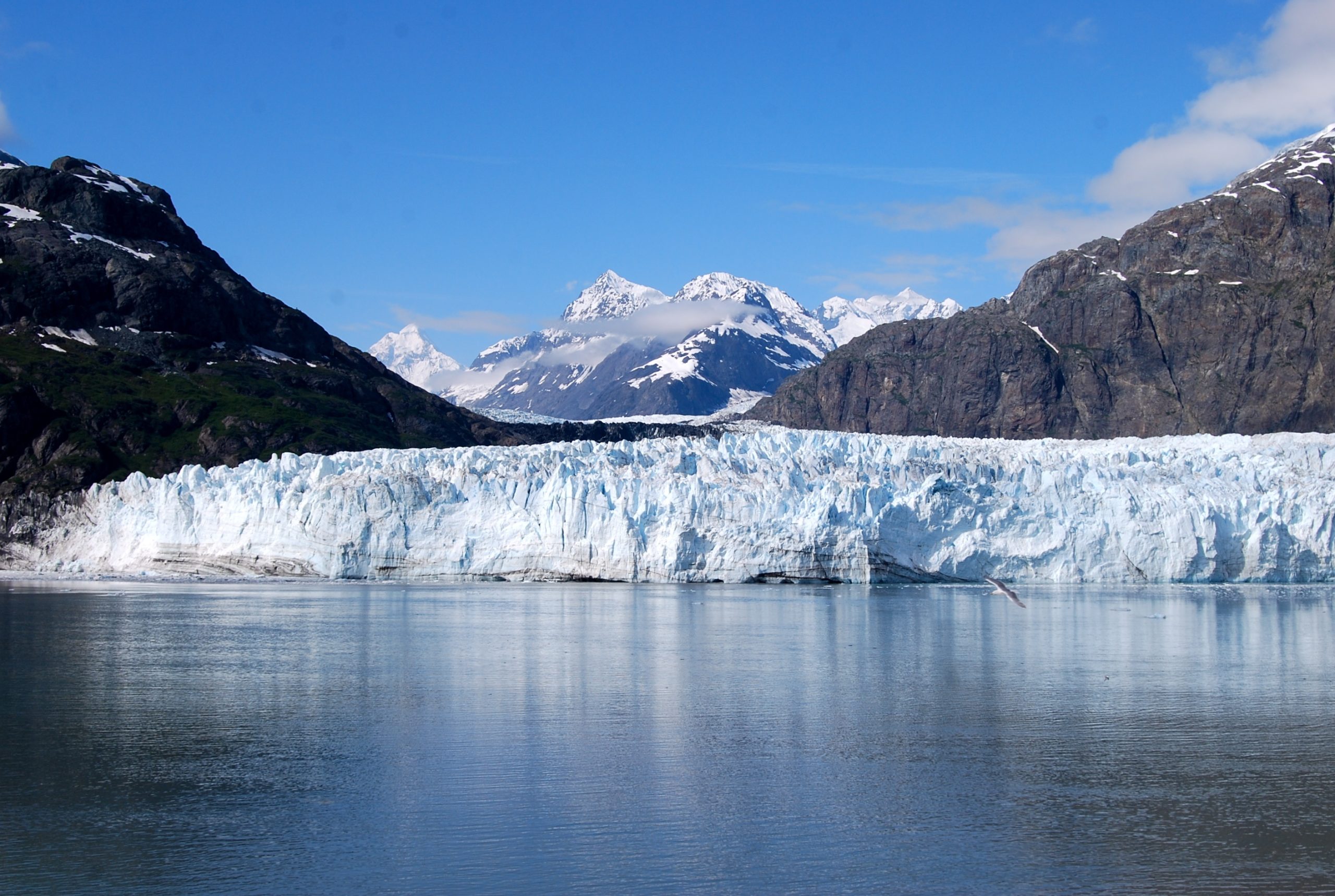
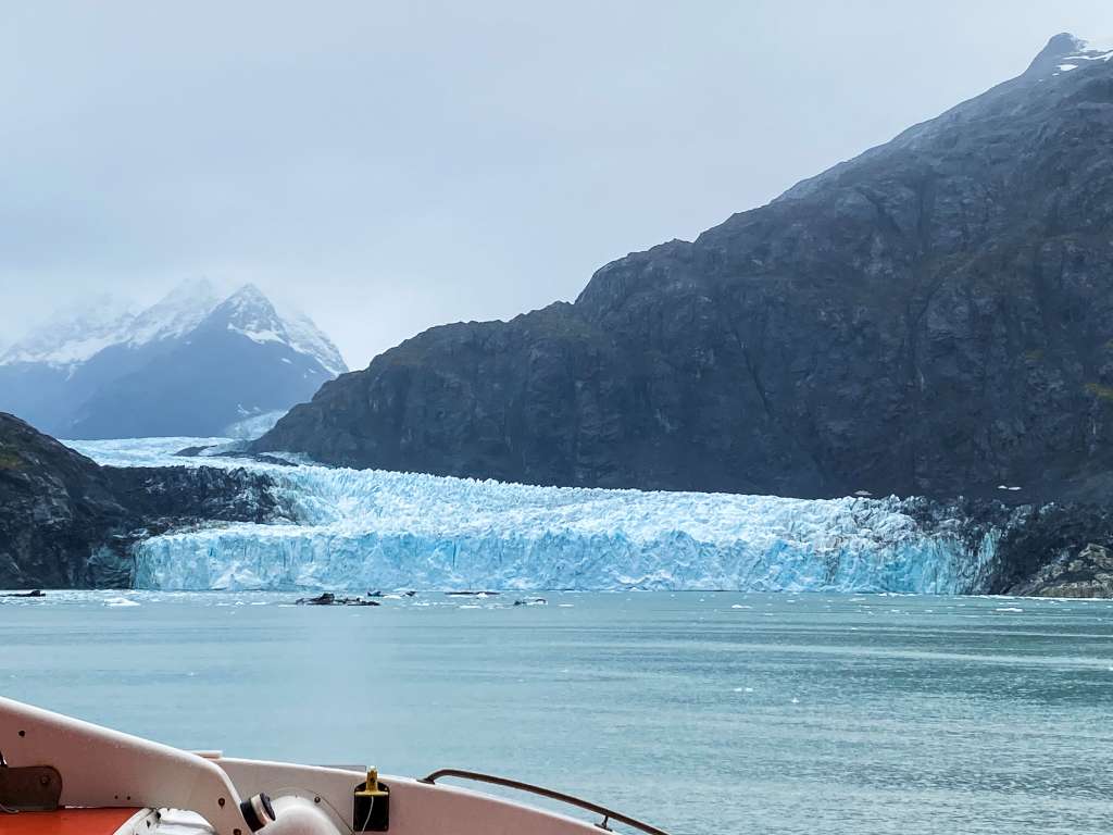
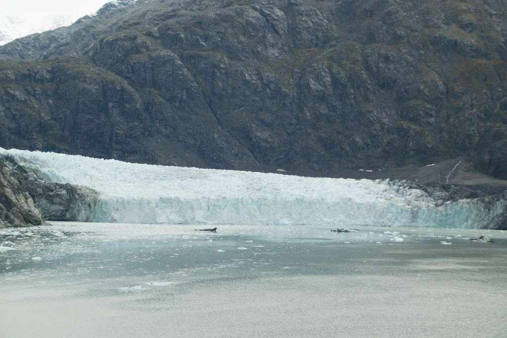
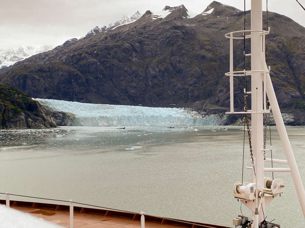
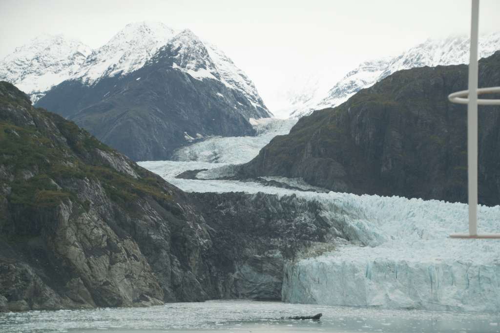
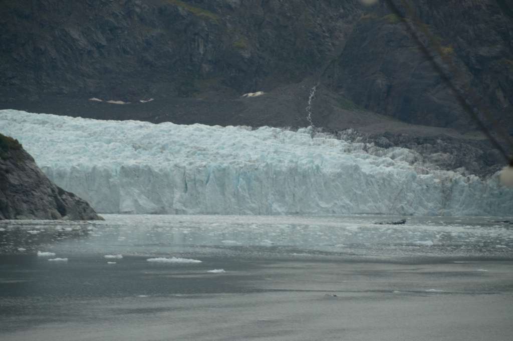
Margerie Glacier is a 21 mi (34 km) long tidewater glacier in Glacier Bay, Alaska, United States within the boundaries of Glacier Bay National Park and Preserve. The glacier begins on the southern slopes of Mount Root, elevation 12,860 feet (3,920 m), on the Alaska–Canada border flowing southeast down the valley, then turning to the northeast toward its terminus in Tarr Inlet. Margerie Glacier is one of the most active and frequently-visited glaciers in Glacier Bay, which was declared a National Monument in 1925, a National Park and Preserve in 1980, a UNESCO World Biosphere Reserve in 1986 and a World Heritage Site in 1992. While most of the tidewater glaciers in the park have been receding over the last several decades, Margerie Glacier has become stable, neither growing nor receding, while Johns Hopkins Glacier is advancing.[2][3][4]
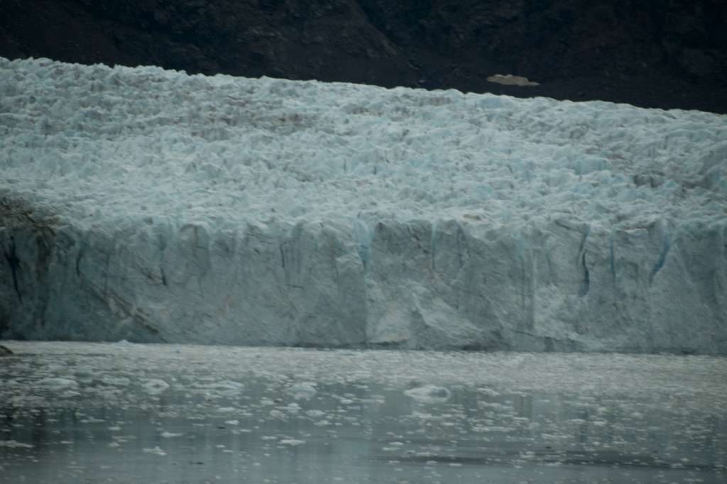
Margerie Glacier extends upstream for a length of 21 miles (34 km) from Tarr Inlet to its source on the southern slopes of Mount Root.[2] The width of the glacier is about 1 mile (1.6 km) and the total height at its terminus is about 350 feet (110 m) including 100 feet (30 m) that is underwater.[3][5]
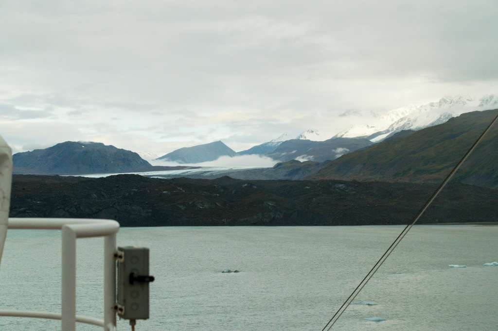
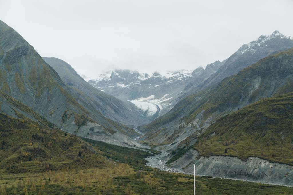
In 1750, Glacier Bay was a massive single glacier but due to higher average temperatures and lower average snowfall amounts over the last several centuries it has been transformed into what is now a 65 miles (105 km) fjord with many smaller glaciers.[6][7] Margerie Glacier is located at the extreme northwestern end of the bay and is situated perpendicular to the Grand Pacific Glacier.[5]
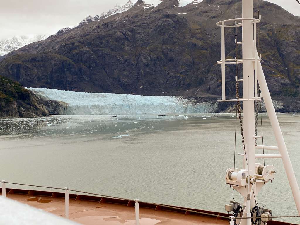
Glacier Bay and its many glaciers are approachable only by air and water as there are no roads in the park. The steep drop off of Margerie Glacier terminus allows cruise ships and smaller park tour boats to anchor nearby providing close-up views of ice calving.[8]
Credit Wikipedia® Margerie Glacier – Wikipedia
Photo credit Eric E Castro from San Francisco
GLACIER BAY RANGERS’ TOP TEN QUESTIONS
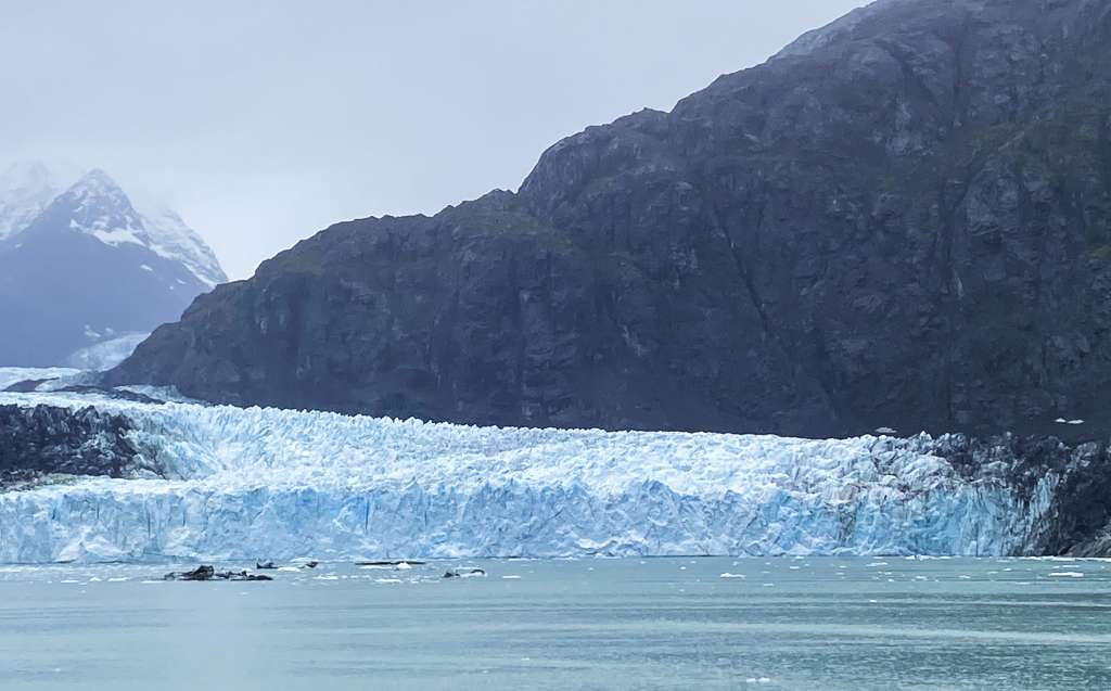
- Why does the ice look blue? When light hits highly compacted glacier ice, long wavelength colors (reds) are absorbed, while short wavelength colors (blues) reflect back through the ice to your eyes.
- Does the bay freeze in the winter? No, the combination of wind, tidal fluctuation, and moderate maritime temperatures keep the bay from freezing over.
- Can anybody bring a ship in here? Any vessel is welcome to visit Glacier Bay. To protect park resources and enhance visitor experiences, the National Park Service limits the number of vessels during the summer months. Two cruise ships may enter each day.
- Where are the whales? Humpback whales are most often seen in the lower portion of Glacier Bay, frequently close to shore. Look for their “spouts” hanging in the air; and remember, even whales can look small from a distance.
- How high is the face of Margerie Glacier? The face of Margerie Glacier is constantly changing. Recently, Margerie Glacier was documented as one mile wide, with a face that is about 200 feet above the waterline.
- Why is the Grand Pacific Glacier so dirty? Avalanches, rock slides, tributary glaciers and the scouring of the valley have caused an accumulation of dirt and rock on the glacier’s surface. Also, the diminishing size of the glacier consolidates the rocks, so that the glacier looks more like land than ice.
- How deep is Glacier Bay? Very deep! It was carved out by a glacier and filled in with saltwater as the glacier retreated, creating a fjord. Much of the bay is over 1,000 feet deep (304 m).
- What are the chances of seeing the glacier calve? The chances are fairly good. These glaciers can move forward over five feet a day! Yet glacier calving is unpredictable. A watchful eye is necessary to catch changes in the glacier’s face.
- What’s the weather like here? It rains a lot — 70 inches (178 cm) a year near park headquarters. May and June are the sunniest, and it is usually not as cloudy near the glaciers as in the lower portion of the bay. The constantly changing moods and quality of the light are part of Glacier Bay National Park’s scenic splendor.
- Is climate change affecting Glacier Bay’s glaciers? Scientists who observe Earth’s climate have documented warming temperatures globally. Decades of data show that Alaska has warmed more than twice as fast as the rest of the earth, causing dramatic changes across the state. Of the more than 100,000 glaciers in the state, 95% are currently thinning, stagnating, or retreating. More importantly, the rate of thinning is increasing. Glacier Bay’s glaciers follow this trend.
Feel free to explore the remarkable images displayed below. Just a click will unveil larger versions for your viewing pleasure!
Best Regards,
Bill & Joan
from vanwykjourneys.ca